Resources > News
New Oregon Coast Conservation Map Available
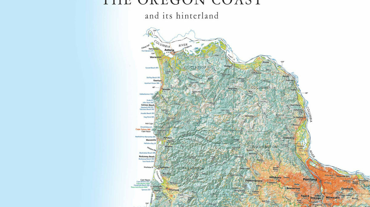

As part of our 2017 celebration of the 50th anniversary of the Oregon Beach Bill, Oregon Shores collaborated with Raven Maps to produce a new large-format, high resolution map of the Oregon coast, emphasizing public lands. The map is now available for order, in time to serve as a beautiful holiday gift for your coast-loving friends and relatives.
The new map highlights the location of each and every Oregon State Park property along the shoreline, along with Oregon’s Marine Reserves, federal wildlife refuges, and other key federal conservation lands. Topography is shown in shaded relief, and a color scheme indicates land cover types including forest, wetland, built/developed land, cultivated land, and grassland/hay.
This is not your ordinary fold-it-up-and-stuff-it-in-the-glove-box road map. Printed in high resolution and vibrant colors on heavy, glossy paper, these are archival giclée prints – fine art quality maps suitable (and recommended!) for framing. The maps are printed at a size of 22 x 50 inches, including 1.75 inch margins to allow for framing. This size will fit on most any door, or will look beautiful on your wall — in addition to providing a handy, detailed reference to the geography and key public sites on the Oregon coast.